UPDATE: 10:30 a.m.
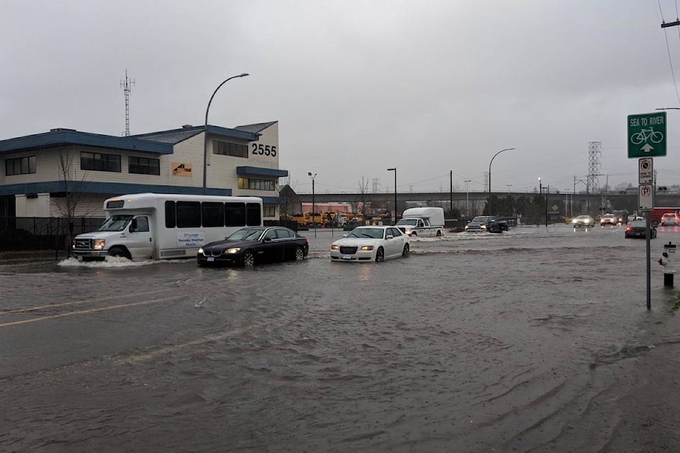
In case it hasn’t been wet enough in the Lower Mainland, a storm front is bringing heavy downpours and powerful winds to the region starting Thursday.
According to Environment Canada, the region can expect to see 70 to 90 millimetres of rain by Friday morning.
The agency is warning the storm could cause flash floods and water to pool on roads.
After the rain the Lower Mainland may also be hit with winds, Environment Canada said.
The national forecaster is calling for southeast winds of 70 kilometres-per-hour for Friday afternoon, before easing by late evening.
Drivers are asked to turn on their lights and watch for washouts near rivers, creeks and culverts.
READ MORE: Row, row, row your car, down a Surrey road
READ MORE: Heavy rain, wind cause power outages in White Rock
Further north the rain will turn to snow on the Sea-to-Sky.
Environment Canada says the region is expecting five to 10 centimetres Thursday, on top of the 15 centimetres that already fell overnight.
Road conditions are changing quickly and could deteriorate as more snow falls.
READ MORE: Hope rescue crew remove man pinned in semi-truck on Highway 3
Looks like @stanrey7 is already making use of the storm brewing. | Shot on #GoProHERO7 #GetTheGoods | @gopro pic.twitter.com/KJPsYYvvRg
— Whistler Blackcomb (@WhistlerBlckcmb) December 13, 2018
Like us on Facebook and follow us on Twitter.