Geotechnical experts will be gauging the risk of further landslides in the Marble Hill Creek watershed above Chilliwack.
Last week city council approved a work plan by Klohn Crippen Berger (KCB) to conduct a ‘landslide and debris-flow hazard assessment’ at a cost of $95,230.
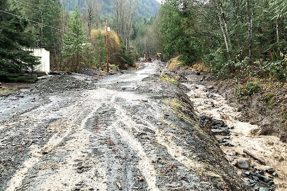
It was the heavy-rain events last fall that put their geoscience work on hold, as officials were focused on repairing slide-damaged creeks, culverts and roads, like the slide on Marble Hill Road at Ramsay Place on Nov. 30, 2021.
The work by KCB geotechs and engineers had been set to start at about the same time, as interest was being expressed in developing hillside properties in the Marble Hill area. KCB had been planning to review the potential risk of rock avalanches and debris flows, in the area to the east of the geologically restricted area.
Since KCB staff has been analyzing ground movement data on Marble Hill for 18 years, “their extensive knowledge of the area and work conducted over the past two decades” made them “uniquely qualified” for this latest work, according to the staff report for the May 17 council meeting.
“During the extreme weather events, it was determined that further hydrotechnical and geohazard mitigation review should be undertaken of the area to reduce risk of future damage by high rainfall events,” according to the staff report.
RELATED: No-build areas of Marble Hill expanded
City of Chilliwack first placed a moratorium on development in the Marble Hill area in 2004.
They later decided to expand the no-build areas in 2016, as recommended by KCB in the wake of ground-truthing and monitoring.
City officials paid out about $21 million to property owners of homes shown to have been built on unstable ground in the Eastern Hillsides. Three of the properties were demolished.
KCB further analyzed data in 2014 and found evidence of movement of greater than two metres in some areas, and in 2016, it produced a landslide map, identifying areas of concern that were added:
• No development in the Ridge Crest rock fall hazard area ( A1 and A2)
• Moratorium on further development in Hinkley Creek suspect slide area Area B; and
• No development in the earthflow area (CI, C2, and C3)
Amendments to the Eastern Hillsides Comprehensive Area Plan Land Use Plan were to rename the “Subject to No Build Moratorium” area as “No Build Area,” and expand this area to include Areas CI, C2 and C3.
The original 2004 development moratorium map included: Panorama Drive, Allison Place, Ridgeview Street and Ridgeview Place.
City officials now say they are seeking “assistance in developing risk tolerance criteria” to guide policy for development in this area. After last fall it was recommended that city officials authorize a hydro technical assessment of the area and make geohazard mitigation recommendations.
RELATED: Moratorium expanded in 2017
RELATED: Heavy rain damaged Marble Hill Road in 2021
Do you have a story idea to share? Email:
jfeinberg@theprogress.com
@CHWKjourno
Like us on Facebook and follow us on Twitter.